


The fastest data-to-decision platform for construction and mining
Real-Time
insights
instant access to site data for faster decisions
Effortless Integration
combine scans from Sodex, drone data and survey files in one platform
Scalable
works anywhere – from small sites to large mining operations
Clear Dashboards
share key numbers with stakeholders
Anywhere – Anytime
secure cloud access in the field, office, or at home
Seamless Ecosystem
End-to-End porivided workflow from scanning to decisions with SDX-Systems and SDX-Cloud
Industries we serve
Handheld
Capture site data anywhere with compact, portable smartphone scanners – fast, flexible, and always by your side.
Learn more

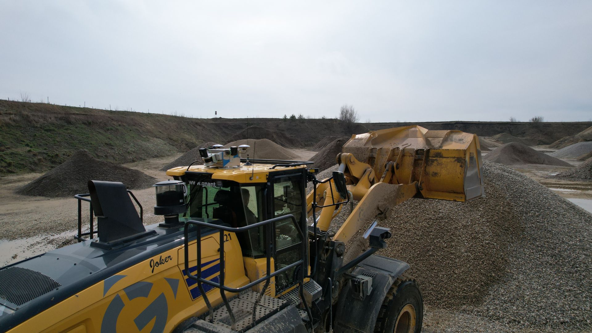
Machine-Mounted
Turn your heavy machinery into automated survey tools that scan while they work – no extra effort or staff required.
Learn more
Customer Stories
”The comparison clearly shows that the new workflows are more efficient. Independent of weather conditions and much more user-friendly.”
”Using a rover or total station, this would take half a week or more. With the Sodex box, it’s done in half an hour to an hour.”
”Sodex Innovations’ software has transformed the way we work. Our teams have found it intuitive and easy to use. It has significantly reduced our admin time while providing instant access to live data, giving us real-time visibility across multiple sites. It ticks all the boxes for us!”

”Simple, intuitive handling, fast results – mass calculations and visualizations made easy.”

SDX-CLOUD
Effortlessly manage and analyze site data, seamlessly integrating with your existing workflows.
Learn more

Turn your heavy machinery into surveying devices.
Laser Scanners and cameras map your terrain in real-time while the machines are working!
Free Demo

Subscribe to our Newsletter
Stay up to date with the latest news in construction tech, our products and industry insights.