
The best automatic Surveying
for the best price
Trusted by the worlds leading businesses


Free Forever
Best for one-man teams
Free
forever
Get Started
Included
- 1 User included | 100 GB Storage
- 10x Data Model Export per Month
- 10x Exports of Reports & Drawings per Month
- Max. 5 Automatic Volume Calculations per project
Photogrammetry
- 5 Credits for free on Sign-up
Base
Ideal for medium-sized businesses
1.600 €
per year
Get Started
Included
- 3 Users included | 2 TB Storage
- Unlimited Data Export
- Unlimited Exports of Reports & Drawings
- Unlimited Automatic Volume Calculations
Photogrammetry
- 5 Credits for free on Sign-up
Enterprise
Specially designed offer for large teams
Get a custom quote by contacting us
Contact Sales
Everything in Base, plus:
- Unlimited Users | Storage Space Based
on Custom Quote - Customer Success Manager
- Free API Integration Support
- 24/7 Support
Photogrammetry
- 5 Credits for free on Sign-up
Full list of features
Photogrammetry Credits Calculator
Calculate the credits you will use:
Try SDX-Cloud First Hand for Free
Sign up for the free tier to explore SDX-Cloud and test the full version free of charge for 30 days.
Get Free Tier

Hardware
We have hardware on demand to help you get the right data.SDX-Compact OnTop
Scanning on Wheel loaders, cars, trucks, dozers
Quarries
Storage Places
Mobile Mapping
max. Scanning Range
30m
Max. Speed
40km/h
Field of View
360°


SDX-Compact
Scanning on Dozers, Scrapers
Earthmoving
Landfills
Road Construction
max. Scanning Range
25m
Max. Speed
40km/h
Field of View
180°
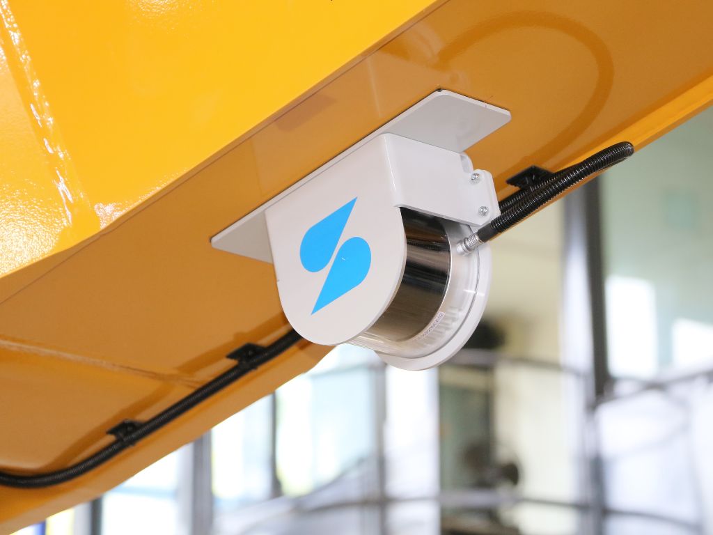
SDX-4DVision
Scanning on Excavators
Underground Utilities
max. Scanning Range
15m
Max. Speed
7km/h
MOUNTING
Fixed Installation on Excavator
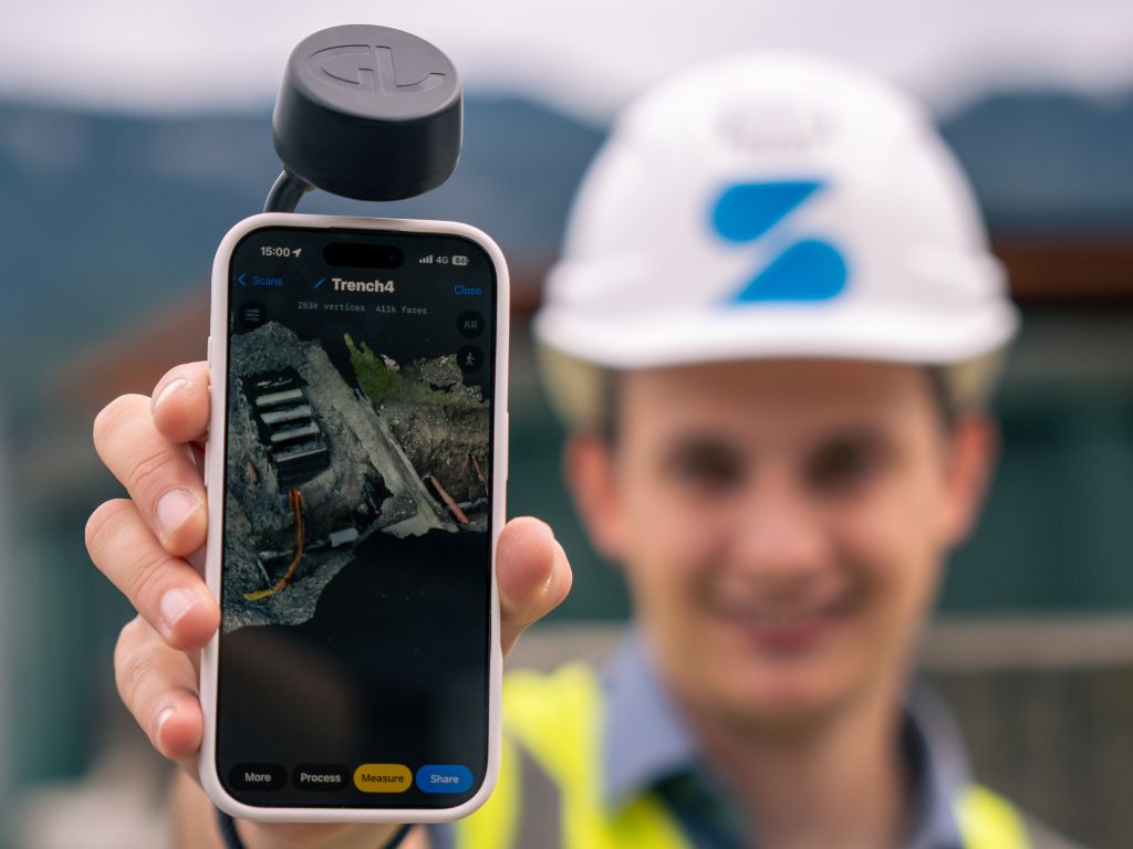
SDX-PocketScan
Handheld Scanner
Small Sites
Earthmoving
Landscapes
max. Scanning Range
3,5m
FIELD OF VIEW
60° x 45°
WORKS WITH
IPhone or IPad pro (12 or higher)
Customer Stories
”The comparison clearly shows that the new workflows are more efficient. Independent of weather conditions and much more user-friendly.”
Learn more
”Using a rover or total station, this would take half a week or more. With the Sodex box, it’s done in half an hour to an hour.”
Learn more
”Sodex Innovations’ software has transformed the way we work. Our teams have found it intuitive and easy to use. It has significantly reduced our admin time while providing instant access to live data, giving us real-time visibility across multiple sites. It ticks all the boxes for us!”

”Simple, intuitive handling, fast results – mass calculations and visualizations made easy.”
Learn more

Turn your heavy machinery into surveying devices.
Laser Scanners and cameras map your terrain in real-time while the machines are working!
Free Demo