
The Software SDX-Cloud
SDX-Cloud is a simple way to keep all your site data in one place. It is a software for site mangers, surveyors and stakeholders to provide a full site overview anywhere and anytime.
Free Demo
35%
Increase in efficiency
<1%
Deviation to actual values
300x
More data available
Everything combined on one platform
Whatever hardware you use to collect your site data, SDX-Cloud ensures smooth integration and combination between all your different surveying technology.

Compatible with your current survey technology
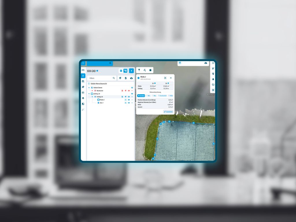
Upload point clouds, linework and surfaces, drone data and many more. SDX-Cloud takes your collected data and transforms it into structured digital documentation, no matter which data capturing devices you use.
Access Data Anywhere
Access all SDX-Cloud features from any device with a browser and internet connection. Whether you’re in the office, at home or on the road, your entire construction site is just one click away.
Simplify your work
SDX-Cloud helps you work faster and smarter. It connects your team on site, all your site data and your stakeholders together into one platform.
How it Works
Data Input and Export
Upload all your data collected on site and combine them to generate downloadable reports, detailed 2D and 3D drawings and much more to give you and your stakeholders a new level of insight.
Measure
Accurately quantify distances, areas, volumes, and elevations directly from high-resolution point clouds.
Compare
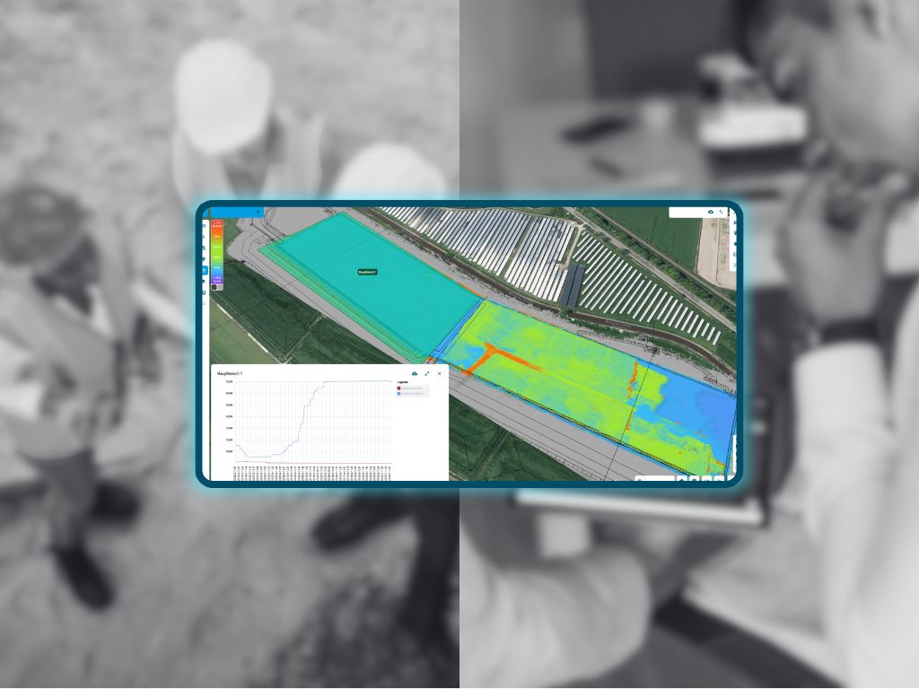
Automatically detect and visualize differences between terrain states or compare against design surfaces to track progress or deviations.
Inspect
Visually analyze terrain conditions and surface details to identify changes, issues, or irregularities.
Document
Create and export comprehensive visual and metric reports for project tracking, handovers, or compliance.
Decide
Use dashboards and analytics to make informed operational decisions based on real-time site data and key performance metrics.
Try SDX-Cloud First Hand for Free
Sign up for the free tier to explore SDX-Cloud and test the full version free of charge for 30 days.
Get Free Tier


Turn your heavy machinery into surveying devices.
Laser Scanners and cameras map your terrain in real-time while the machines are working!
Free Demo