BHI Brings Real-Time Inventory Tracking to Aggregate Operations
BHI is no stranger to technology. With over 300 drone flights a year, Trimble machine control across its fleet, and rovers on a lot of sites, the team already runs one of the more data-driven operations. But even with all of that in place, there was still a gap: continuous, real-time terrain and inventory data without having to send someone to collect it. The SDX-Compact filled that gap for them.


Overview
BHI is no stranger to technology. With over 300 drone flights a year, Trimble machine control across its fleet, and rovers on a lot of sites, the team already runs one of the more data-driven operations. But even with all of that in place, there was still a gap: continuous, real-time terrain and inventory data without having to send someone to collect it. The SDX-Compact filled that gap for them.
Used Systems
SDX-CloudSDX-Compact OnTop
The challenge
Plenty of Data, But Not Often Enough
BHI runs aggregate pits, asphalt plants, large-scale earthworks, utility installation, and solar projects all across Utah. The team flies drones at some sites multiple times a week and uses GNSS rovers for spot checks. But drone data is periodic. It gives you a snapshot in time, not a stream and until all that data is processed, conditions on site have already changed – piles shifted, material got hauled and ground levels moved.
At remotely located sites, the problem is even worse. Getting a surveyor or drone pilot out there means two or three days of travel for a single dataset. And even on well-staffed sites, the data still has to pass through one person with a dedicated software before anyone else can act on it.
The team wanted something that could run on its own, capture data as part of daily operations, and make that data available to everyone who needs it at the same time.
Our Solution
Continuous Automatic Scanning While the Work Happens
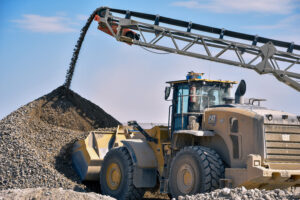
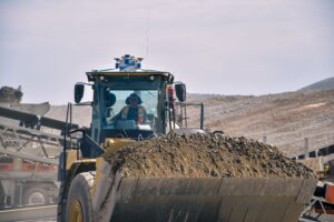
BHI mounted the SDX-Compact on a wheel loader at their aggregate site near Salt Lake City. With the auto-start functionality the system runs as soon as the machine powers on. As the loader then moves material throughout the day, the LiDAR scanner continuously captures terrain data in a 140 ft radius around the system that ends up as an updated point cloud in SDX-Cloud. There is no operator interaction needed. The data just shows up in the office.
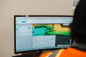
In SDX-Cloud, the data is accessible within 10 to 20 minutes. Project managers, operations teams, and even external stakeholders can open a dashboard with all important numbers from anywhere via a sharable link. Our solution is all cloud based, so there is no need for a separate software. On some days, the team just has the portal up on a screen in the office, watching the data come in live.
Customer Feedback
"It fills a hole we had. We want to do more with less people, be more efficient. This fits perfectly."

Mitch Hansen
VDC Manager, BHI
Next Steps
From Aggregate Pits to Utility Trenches
The aggregate site is just the starting point. BHI sees use cases across nearly every type of project they run. Utility installation is high on the list, with plans to mount the SDX-Compact on trackhoes to capture trench and pipe data during excavation. Haul trucks on large cut-and-fill jobs are another target, giving the team live volume tracking as material moves.
Mitch sees machine-mounted scanning as the logical next step beyond GNSS and drones. Not as a replacement, but as the piece that makes the data continuous instead of periodic. Drones still pick up areas the LiDAR can’t reach. Rovers still handle high precision spot-checks. But the SDX-Compact captures everything in between, multiple times a day.
The operations teams took some convincing at first. More data meant more to look at. But after a few weeks, the value became obvious. When a change order comes in or someone needs to know exactly what happened on a given day, the data is already there and with the calendar view you can go back in time and look at the data at a certain date to prove your statement.
The Result
Live Data, Zero Extra Effort
With the SDX-Compact running on the loader, BHI now tracks aggregate inventory in near real-time without pulling anyone off their regular work. The data updates throughout the day, giving the team current pile volumes, ground elevations, and production quantities that used to only come from periodic drone flights or belt scale estimates.
Switching the system between sites or even machines takes minutes. Cloud-based dashboards put the important numbers in front of the people who actually make decisions. And the export tools let the team pull point cloud snapshots for documentation, comparison, or further analysis in other software whenever they need it.
Customer Feedback
"The next step up from what GPS and drone data has been is this: we're getting info multiple times a day, not just periodically through the year. That's the key with Sodex Innovations."
Mitch Hansen
VDC Manager, BHI
Turn your heavy machinery into surveying devices.
Laser Scanners and cameras map your terrain in real-time while the machines are working!
Free CLOUD Demo