
Your one-stop surveying solution
Sodex provides end-to-end surveying solutions. From automated machine scanning to cloud-based analysis, giving construction teams faster insights, accurate documentation, and streamlined workflows across different industries and all project types.
Industries we serve

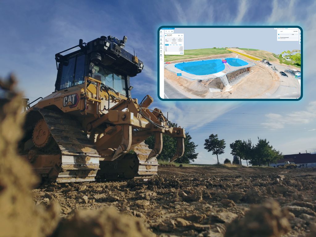
SDX-Compact
- High accuracy scanning directly from construction machines
- Reliable 3D terrain documentation
- Easy to swap between machines in just minutes
- No calibration required
- Automatic upload to SDX-Cloud for instant access
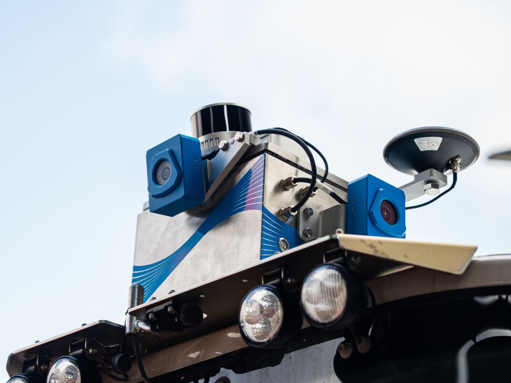
SDX-Compact OnTop
- High accuracy scanning directly from construction machines
- Full 360° scanning range for complete site coverage
- Ideal for stockpile measurement and volume tracking
- No calibration required
- Automatic upload to SDX-Cloud for instant access
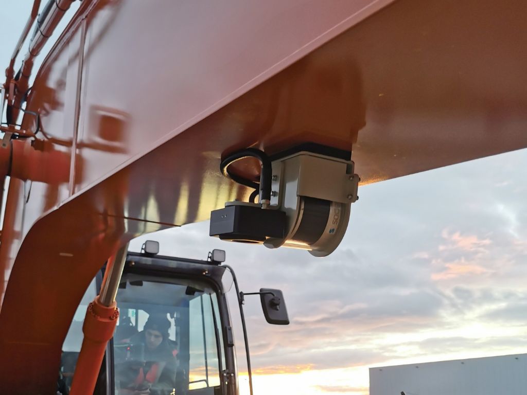
SDX-4DVision
- Real-Time scanning directly from the excavators arm
- Perfect for trenches, piles and as-built documentation
- Operator can survey and work at the same time
- Automatic upload to SDX-Cloud for instant access
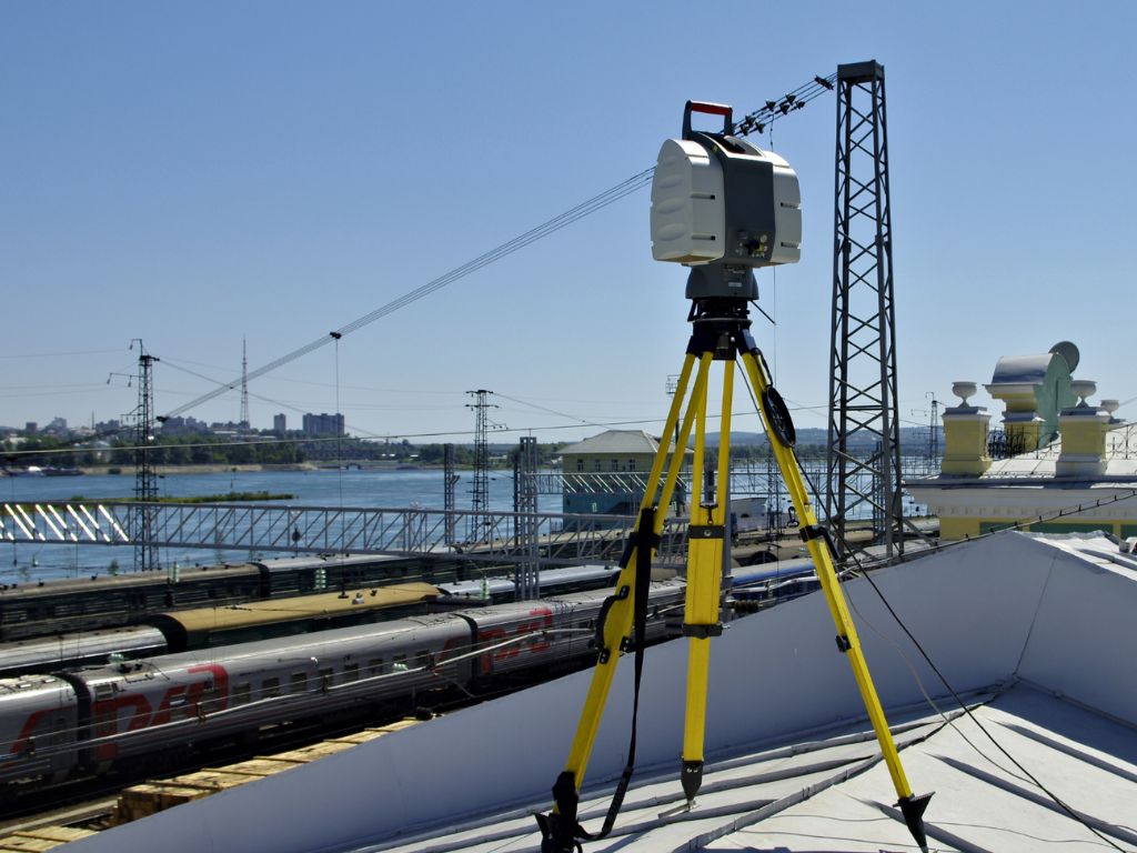
Terrestrial Scanners
- High accuracy and detail
- Reliable 3D reality capture
- Strong performance in complex enviroments
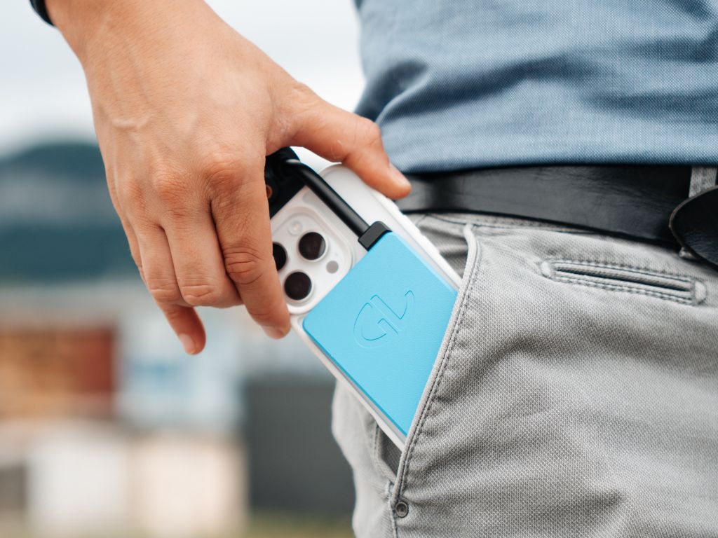
SDX-PocketScan
- Compact and portable scanner for flexible field use
- Quick scans for small areas or hard to reach spots
- Easy to carry and intuitive handling
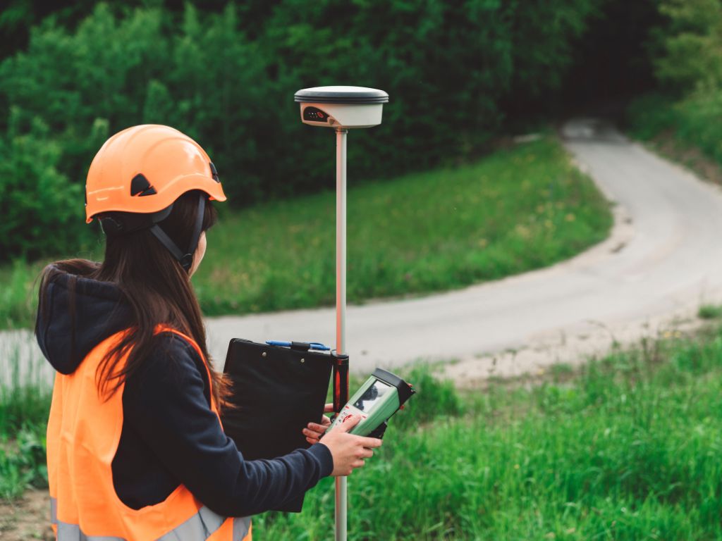
GNSS Rover
- Quick an precise point measurements on site
- Easy staking out and documentation of coordinates
- Portable and simple to operate

Drones
- Fast capture of large areas and construction sites
- High-resolution imagery for mapping and documentation
- Flexible for different project sizes and terrains
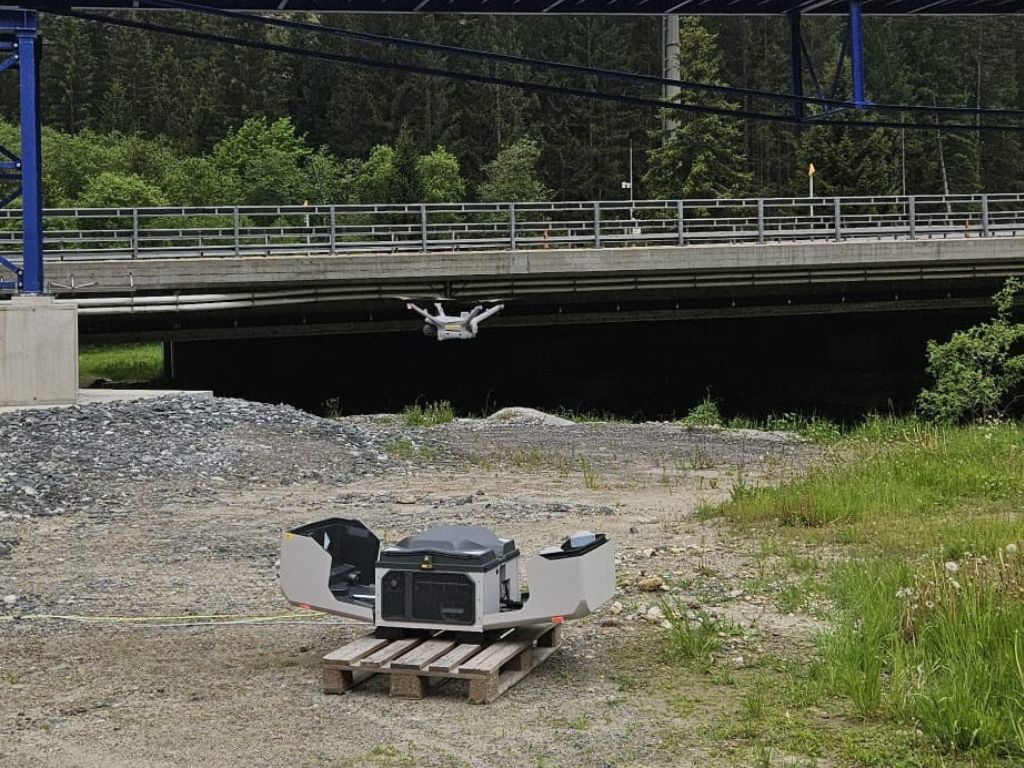
DJI Dock
- Fully automated drone flights for regular site scans
- Reliable data capture without manual piloting
- Ideal for frequent progress documentation and monitoring
Hardware
Rugged SDX-Systems designed for precise construction surveying in real-world conditions

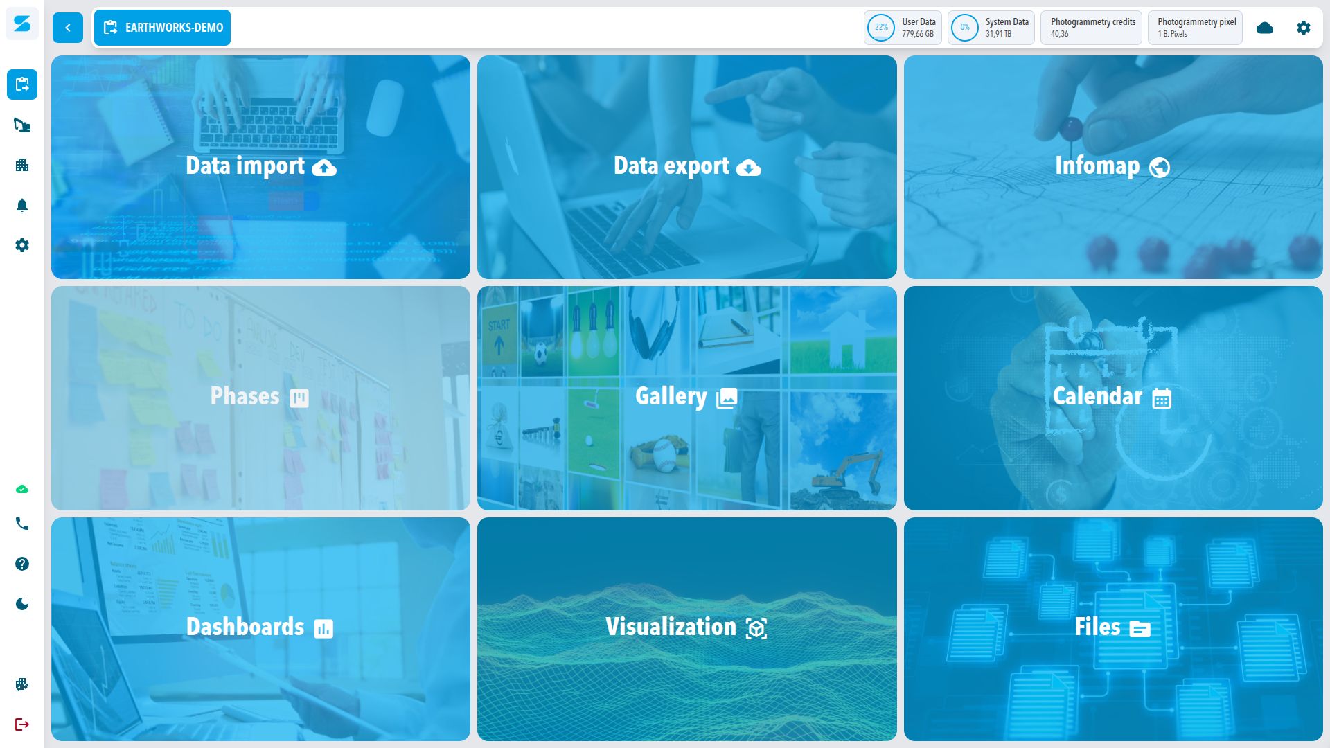
Software
SDX-Cloud – one platform for cut fill analytics, construction as-built documentation, construction progress monitoring any many more features to make surveying data analytics more efficient
Customer Stories
”The comparison clearly shows that the new workflows are more efficient. Independent of weather conditions and much more user-friendly.”
Learn more
”Using a rover or total station, this would take half a week or more. With the Sodex box, it’s done in half an hour to an hour.”
Learn more
”Sodex Innovations’ software has transformed the way we work. Our teams have found it intuitive and easy to use. It has significantly reduced our admin time while providing instant access to live data, giving us real-time visibility across multiple sites. It ticks all the boxes for us!”

”Simple, intuitive handling, fast results – mass calculations and visualizations made easy.”
Learn more
